
Wyoming ZIP Code Directory Coverage
The official Michigan ZIP map labels Wyoming with 49509, 49519, and 49548. It is dated October 22, 2009, so it is a general reference rather than a legal boundary survey. Official city and state address examples add 49418 and 49508 to the local postal picture. Census ZIP Code Tabulation Areas also intersect several nearby labels, but that statistical overlap does not mean every one is a Wyoming mailing ZIP.
| ZIP | Areas covered | Post office | Notes |
|---|---|---|---|
| 49509 | City Hall and central Wyoming examples | Wyoming Post Office and Rogers Plaza | Facility ZIP+4 differs by office |
| 49519 | Official Wyoming and southwest-area examples | Complete facility boundary not located | Confirm municipality and parcel |
| 49548 | Official Wyoming address examples and industrial or commercial delivery context | Post-office assignment not located | Not proof of an exact city boundary |
| 49418 | Ivanrest utility example with a Wyoming city label | Grandville-area postal context | Verify the physical parcel separately |
| 49508 | Official state-listed Wyoming address examples | Assignment not located in official sources | Postal overlap requires a street check |
| 49503, 49507, 49315 | Nearby or Census ZCTA intersections | Grand Rapids or statistical context | Not confirmed Wyoming mailing labels |
Use the postal label exactly as supplied, then add a street and municipality. The city cannot be reduced to a short, fixed list of ZIP areas from the research materials, because no current official street-by-street boundary table was located.
Wyoming ZIP Code Postal Overlaps
ZIP geography and city geography answer different questions. For legal property research, the parcel ID and situs address control. For delivery, USPS ZIP and ZIP+4 control. For census comparisons, the ZCTA is a statistical area. Keeping those labels apart prevents a postal result from sending a searcher to the wrong city office.
Wyoming has a compact local example. City Hall uses 49509, while the city wastewater utility at 2350 Ivanrest Avenue SW carries 49418. The same 28th Street also crosses Grandville, Wyoming, Kentwood, and Cascade. A directional suffix and municipal result therefore matter even after a ZIP code appears to fit. Treat them as separate fields, then check the parcel before asking a record custodian for detail.
Note: The official map is a useful orientation tool, but USPS address lookup is the right final check for a specific delivery address.
Wyoming ZIP Code USPS Facilities
USPS lists the Wyoming Post Office at 2929 Michael Avenue SW with the facility label 49509-9998. The listed lobby and retail hours are Monday through Friday from 9:00 a.m. to 4:00 p.m., and Saturday from 9:00 a.m. to noon. Rogers Plaza, at 1026 28th Street SW, is separately listed with 49509-9997 and different retail and PO-box hours.
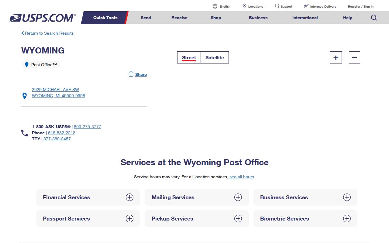
These office ZIP+4 endings identify facilities or routes, not an entire list of delivery addresses. They are useful for checking office services, collection information, and PO-box access. Confirm current hours with USPS before a visit because office operations can change.
Finding Residents Within a Wyoming ZIP Code
A ZIP code does not produce an official public resident roster in the sources reviewed. It narrows a search only after another detail is available, such as a full address, a street, or a person who has supplied the information needed for the official tool. This sequence protects against merging records from adjacent postal areas or assigning a Wyoming label to a neighboring parcel.
- Use USPS or the Michigan ZIP map to retain the exact postal label and identify the likely city or street context.
- Add a house number, directional suffix, and municipality. If the address is on 28th Street, test the returned jurisdiction rather than assuming Wyoming.
- Search the address in Kent County Parcel Mapper or the county Property Search to confirm the parcel and situs address.
- Use the property record only for parcel-linked fields. A mailing address, owner name, or map result needs its own record context.
- For a named person, use the appropriate official record with its required inputs and compare the returned jurisdiction. A ZIP alone is too broad for a reliable match.
After the postal label has narrowed to a street, the Wyoming street directory has the address-by-address property, map, deed, permit, and historical workflow.
Wyoming ZIP Code Portal Fields
Official tools use ZIPs in different ways. USPS accepts a location, address, or ZIP to return facility information. The Michigan public registry permits city, county, ZIP, and address-radius searching within its statutory record type. Michigan Voter Information Center is not a free ZIP-only directory: it requires first name, last name, birth month, and birth year. Kent property search and Parcel Mapper accept an address, not a documented open ZIP-only filter.
| Official tool | ZIP-related inputs | Output or limit |
|---|---|---|
| USPS location search | Location, address, or ZIP | Postal facility and service details |
| Michigan registry | Street, city, county, ZIP, radius, and status filters | Statutorily published records only |
| Michigan Voter Information Center | Name plus birth month and year | Registration and election-administration result, not ZIP browsing |
| Qualified Voter File request | Jurisdiction, district, school, village, ward, or precinct | Formal geography request, not a simple public ZIP export |
| Kent Property Search and Parcel Mapper | Address or parcel search | Parcel and map context; ZIP-only field not documented |
The QVF request form allows specific government geographies and includes protected-field limits under Michigan election law. It should not be treated as a shortcut around the limited public voter lookup. If an agency record is needed but no portal covers it, send a narrow written request to the correct city or county custodian.
Note: A portal field that was not exposed in official materials is not a promised search option. Check the live official interface before relying on it.
Wyoming ZIP Code City Limit Checks
Postal boundaries can cross municipal boundaries, and city addresses can retain an adjacent-community ZIP. Before requesting a property or city record, compare the postal address with the situs, parcel ID, municipality label, and directional suffix. The city map route offers REGIS tools such as ParcelFinder and Census Map for regional orientation, but the parcel record is the stronger jurisdiction check.
- ZIP code
- A postal routing label used to sort and deliver mail. It is not a city boundary or parcel identifier.
- ZIP+4
- An added four digits that identify a more specific delivery segment, route, or facility context.
- PO-box ZIP
- A ZIP used for postal boxes or a postal facility. It does not establish a person's physical address.
- Unique ZIP
- A ZIP assigned to a single organization or delivery arrangement when USPS uses one.
- Carrier route
- A delivery route used by mail carriers, separate from a legal or municipal boundary.
Historical directories may have no ZIP at all. Do not add a modern ZIP to an old entry as though it appeared in the original. Compare the street, house number, municipality, and map or plat context first, and label any modern postal normalization as such.
Historic Wyoming ZIP Code Labels
Older Wyoming research often begins with an address that predates the ZIP system or uses a township, county, or regional directory label. Wyoming incorporated as a city in 1959, so older material can be filed under township-era or Kent County wording. The Grand Rapids Public Library's suburban Kent County directory run covers 1957 through 1997, and later East/West county editions are listed from 1998 forward.
Use a historical directory as a dated address clue, then translate it through a parcel description or plat before applying current postal geography. The Library of Michigan's Kent guide also points to county atlases, census work, deed indexes, newspapers, and other historical materials. None of those sources turns a historical postal label into proof of a current address.
The regional runs have publication gaps, including listed R.L. Polk gaps in 1947, 1950, 1952, 1957, 1989, and 1991. A gap in an edition is not proof that an address vanished or that a household moved. Compare the available edition before and after the gap, then keep the historical street number, city wording, and source date together. If a deed or tax record uses a legal description rather than a street address, use a plat or the assessor record to bridge the two descriptions.
The Grand Rapids Public Library house-history route also identifies older deeds, assessment files, tax history, plats, maps, newspapers, and address-organized listing cards as separate layers. These materials can confirm how an address was described in a particular period. They should not be recast as a modern ZIP code directory entry.
Safe Use of Wyoming ZIP Code Data
ZIP data is broad, and combining several public records can still create an intrusive profile. Keep the search tied to a clear, lawful purpose such as family history, confirming the correct property custodian, estate research, or checking an official mailing address. Name the record type and date instead of presenting a postal label as proof about a person.
Michigan's Address Confidentiality Program gives qualifying people a designated address and mail forwarding. A substitute address, missing address, or redaction is a safety measure, not a clue to defeat. Michigan FOIA allows agencies to redact exempt information, and a focused request should identify the record, date range, location, and preferred delivery.
Note: A city name, ZIP label, and physical parcel should agree before a municipal record request is sent to Wyoming rather than a neighboring custodian.